Christmas tree farm report – May 13, 2024
 Print
Print Email
EmailAbove-average temperatures continue to hasten tree and pest development.
Pest update
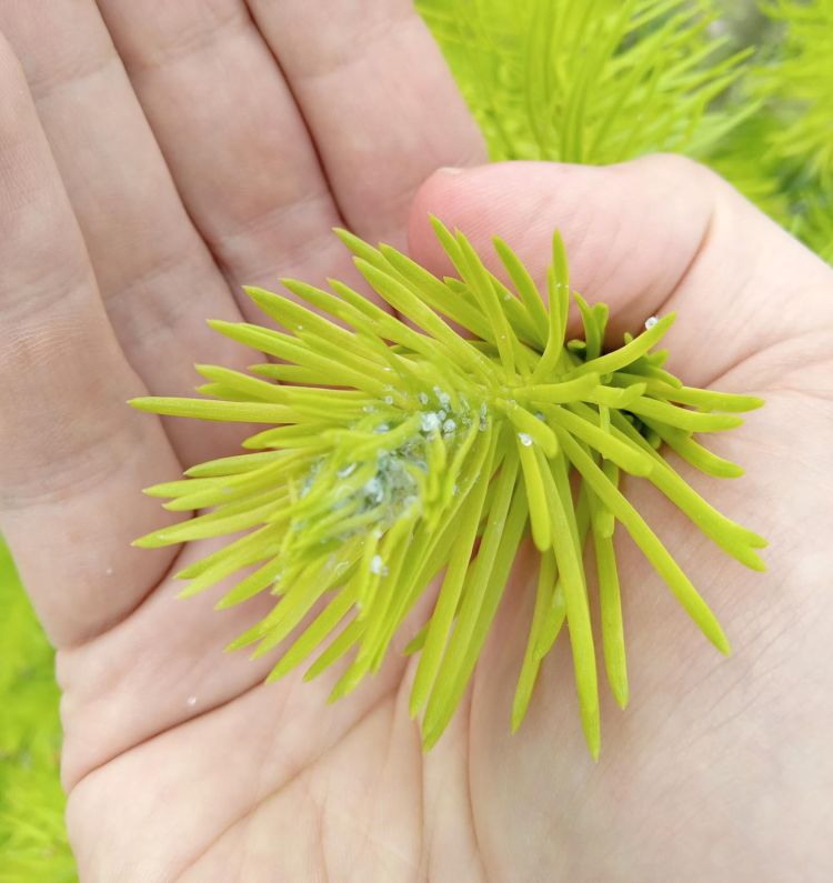
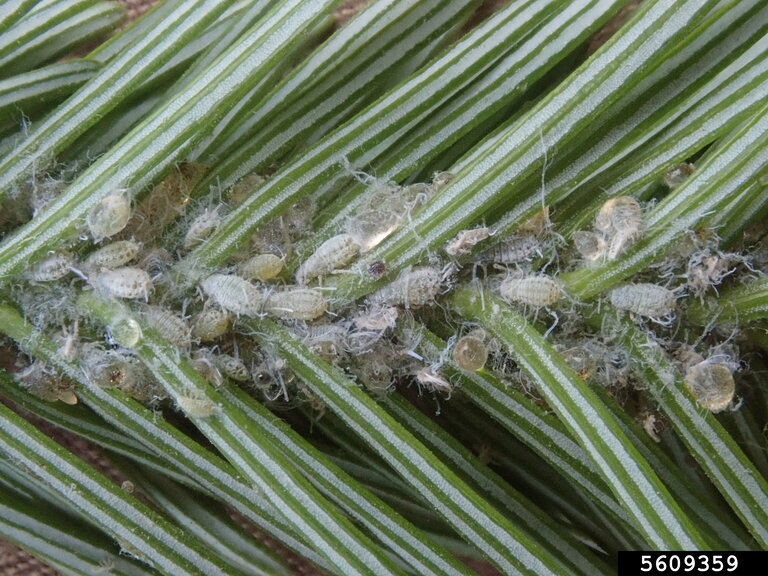
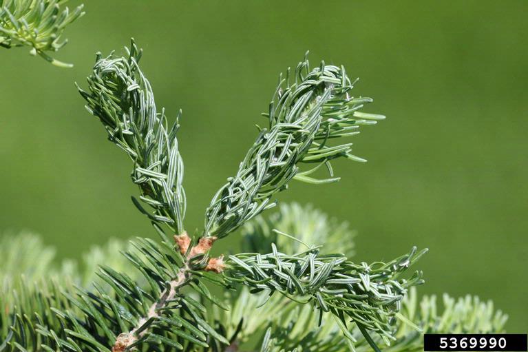
Balsam twig aphid (Photos 1 and 2) damage has been reported in southern Michigan. Balsam twig aphid can damage any true fir species, although species that break bud early, such as balsam and Concolor, are more commonly affected. Balsam twig aphid feed on developing needles resulting in abnormal, deformed growth (Photo 3); high levels of feeding can reduce overall tree growth. The treatment window for balsam twig aphid is 100-150 growing degree-days (GDD) base 50 degrees Fahrenheit, targeting the stem mother generation. Most of Michigan is well past that window, with the second generation (sexuparae) already emerged and feeding. Treatments at this point will not prevent the current year’s damage.
Finally, some level of balsam twig aphid damage is acceptable. In a consumer study, customers had no discernable difference between trees that had 30% of all shoots damaged by balsam twig aphid and those of non-damaged trees.
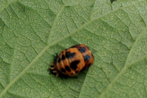
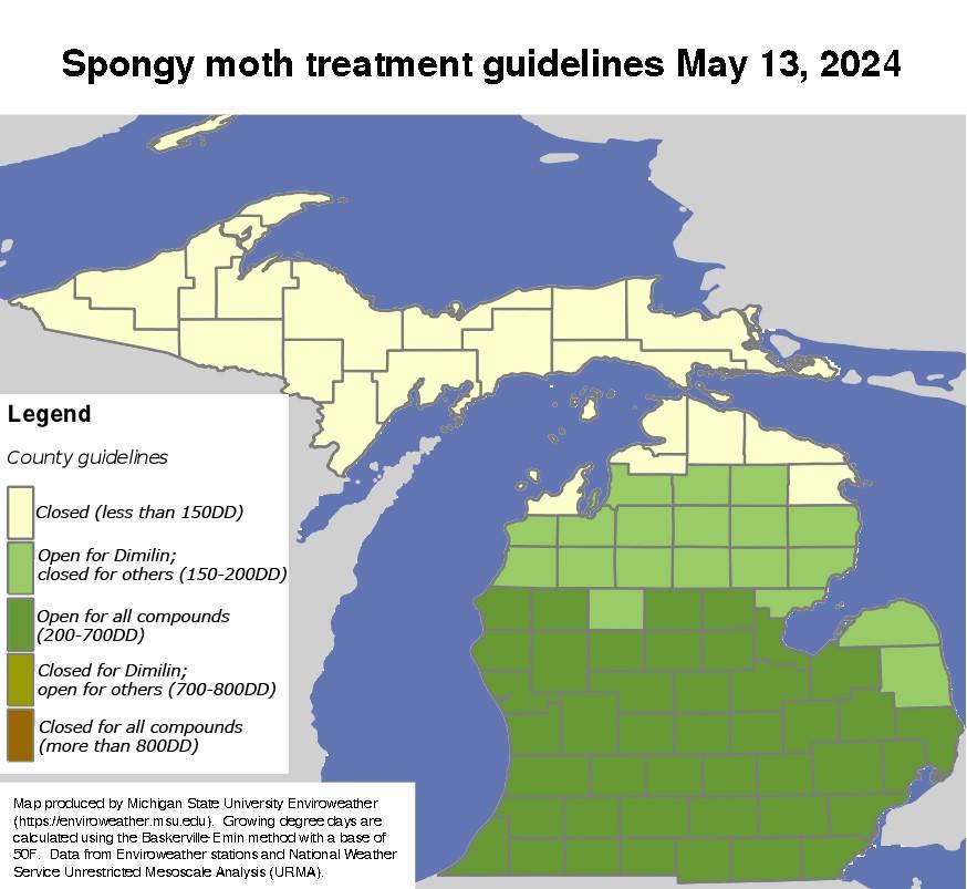
Treatment windows for spongy moth have opened in some counties (Photo 4). Spongy moth rarely causes widespread damage to Christmas trees since it is not a preferred host, but is of regulatory importance based on where and how trees are sold. Grower reports of high populations of spongy moth in southwestern Michigan, but much lower levels, are expected throughout the remainder of the state.
Weather report
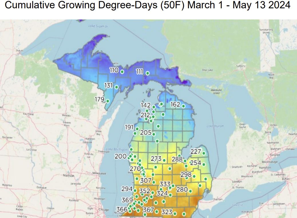
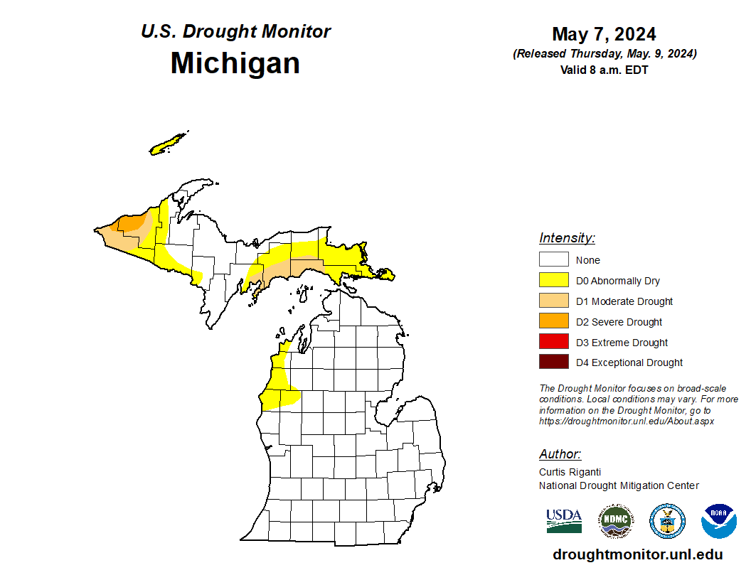
Current GDD accumulation vary across the state from about 360 GDD50 in southern Michigan (weather station location, 10-14 days ahead of normal) to 200 GDD50 in northern Michigan (weather station location, three days ahead of normal) (Photo 5). The Upper Peninsula has approximately 110 GDD50, which is near normal. Predictions for the next several weeks include above average temperatures. It has been an active period of precipitation for the Lower Peninsula, with several rounds of thunderstorms and some severe weather including tornadoes in the Kalamazoo, Cass and St. Joseph counties. Small portions of the Upper Peninsula remain in abnormally dry to severe drought conditions (Photo 6).
Farm report
The majority of preemergent herbicide and fertilizer applications as well as tree plantings are finished. Budbreak of species ranges from many inches in early budbreak species to initial budbreak of later species. Cone removal is in full swing throughout southern Lower Peninsula.
Upcoming events
Michigan State University Extension will be hosting a Christmas tree field day on June 14, 2024. Other educational opportunities include the Michigan Christmas Tree Association Summer Field Day on July 24 – 25.