Grand Rapids area tree fruit update – June 29, 2021
Extensive rainfall over the past week replenished soil moisture deficits, but a return to warm, dry weather is expected.
Weather update
Over the past week, the Grand Rapids, Michigan, area received an extensive amount of rainfall, as in much of the rest of the state. Precipitation recorded at Michigan State University Enviroweather Weather stations across the area ranged from approximately 3 inches to over 5.5 inches of total rainfall over a three-day period from June 24-26 and an additional 0.1-0.4 inch in some places on Monday, June 28. This rainfall was sorely needed and contributed significantly to replenishing precipitation and soil moisture deficits. This is important as we move into the period of the season with most intensive water demands.
Despite the rain, much of the Grand Rapids area continues to be under a drought conditions according to the U.S. Drought Monitor. While much of the state was moved to D1 (moderate) drought conditions, a large portion of Kent and Newaygo counties are still under D2 (severe) drought.
Temperatures over the past week were slightly lower (3-4 degrees Fahrenheit) than long term averages, but overall heat accumulation this season continues to be ahead of normal. The MSU Sparta Enviroweather station has accumulated a total of 1,577.7 degree days base 42 since Jan. 1, indicating the region is still approximately nine days earlier than the average for June 28.
The most severe storm conditions were primarily to the outside of the Grand Rapids region. Extensive flooding was reported in many areas of Michigan but has not had a major impact on the fruit production regions in the Grand Rapids area. High winds and six tornado touchdowns were reported in central Michigan on June 28, including two in Ionia County and one in Kent County just west of Lowell, Michigan. Again, these were outside the major fruit production areas.
More rain and storms are expected over the next few days, with possible accumulation of 0.1-0.3 inches. The highest probability of storms will be Tuesday afternoon, June 29, followed by scattered rain events on Wednesday and Thursday, June 30-July 1. There is a possibility of thunderstorms each afternoon. Warm summer storm systems are always accompanied by the chance of high winds and hail. The NOAA Storm Prediction Site offers information about predicted and previous storm reports.
The medium and long lead outlook includes a return to warmer than normal temperatures, beginning at the end of the week. Temperatures will include highs in the 80s and lows in the upper 50s-60s. Forecasts indicate warmer than normal conditions are expected for the remainder of the summer and the fall.
Crop update
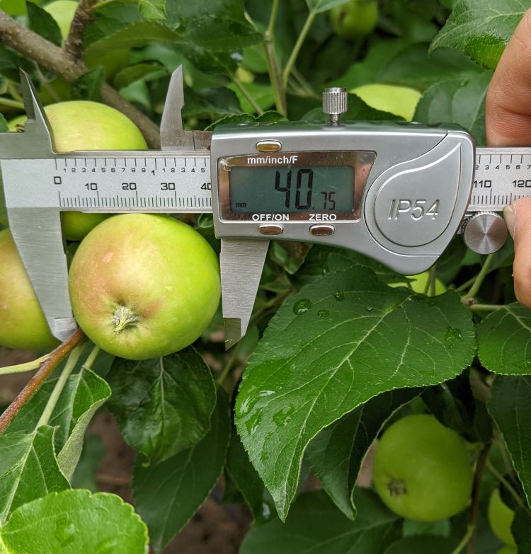
Apples in the Grand Rapids area are continuing to size, with most varieties approximately 1.5 inches or 40-50 grams in size. Some frost damage is now evident from the freeze events in April as frost rings, misshapen fruit and cracking or yellowing of the calyx end of the fruit. Growth will continue rapidly in light of the precipitation over the past week and the return to warmer temperatures this week.
Cherry harvest is beginning in very early varieties. In some cases, the extensive rainfall has led to fruit cracking.
In peaches, hand thinning is complete, fruit is continuing to size, and pit hardening is well underway.
Now is a good time for apple growers to begin taking leaf samples for tissue analysis for monitoring fruit nutrition. Results of foliar analyses are an excellent indication of which nutrients the trees are taking up and utilizing. They can be used to determine if the fertilizer program is meeting the needs of the trees in the orchard, diagnose nutritional problems, and identify developing problems before growth or yield is affected. The best time for sample collection is mid-summer, after shoot growth has stopped. In Honeycrisp, this timing is slightly earlier before “zonal or marginal chlorosis,” the mottled yellowed appearance of leaves common in this variety, becomes too pronounced. More information on Apple Nutrition is available from MSU’s Eric Hanson.
The 2021 predicted apple harvest dates are now available online for all of the MSU Enviroweather stations. Phenology has been approximately one to two weeks earlier than the 30-year average for the duration of the 2021 season. This is the opposite of the past two years, in which cool late winter climate delayed the development of spring buds. Overall, 2021 predicted harvest dates are earlier than normal. Most of the state is a few days earlier compared to the average and last year. The predicted harvest dates for specific locations can be calculated using the Apple Maturity Model on the Enviroweather Website.
Pest update
Even though primary apple scab is over for the general Grand Rapids area, careful scouting for any lesions from the last infection events of the season should be done in the next week to make sure no primary scab got by.
Fire blight symptoms in the general Grand Rapids area are not too common, but there is some blight here and there. Careful scouting needs to continue to make sure any active fire blight is dealt with quickly. If blocks are clean of blight, the risk is so much less if any summer storms occur. If trauma conditions occur, preventative applications will be needed until we get to terminal bud set.
Fungicides are now needed for apple blocks around the general Grand Rapids area for summer disease suppression. The heavy and long rain events over the last week have put many stations over the 200 hours of wetting to cause expression of sooty blotch and flyspeck. These fungicides will also help curb any early start of fruit rots from the heavy rains.
Adult codling moth numbers have declined over the last week. Heavy rains at the end of male activity probably suppressed flight. There are likely a few more eggs to hatch from the first generation and cover sprays after heavy rains should be considered in blocks over threshold. A biofix for the Grand Rapids region was set for May 16. The degree day totals for base 50 since that biofix total 726 base 50. The degree day models indicate the general Grand Rapids area is nearing the end of egg hatch with about a week to go.
European red mites continue to do well. Heavy rain events helped to reduce adult numbers found on leaves for the time being. Continue to monitor – the threshold for European red mites in July is 5 motiles per leaf.
Obliquebanded leafroller adults continue to be found in pheromone traps and numbers are expected to decline over the next week or two. An obliquebanded leafroller biofix for the Grand Rapids region was set for June 7. The degree day totals for base 42 since that biofix total 546. We are nearing 50% egg hatch and small larvae should become easier to find. The timing for management will depend on your population – high populations need cover sprays now, lower populations need cover sprays when small larvae begin to be found.
Green apple aphids (also known as Spirea aphid) are now building quickly on growing terminals in apples. It’s easier to also find several species of aphid predators in aphid colonies.
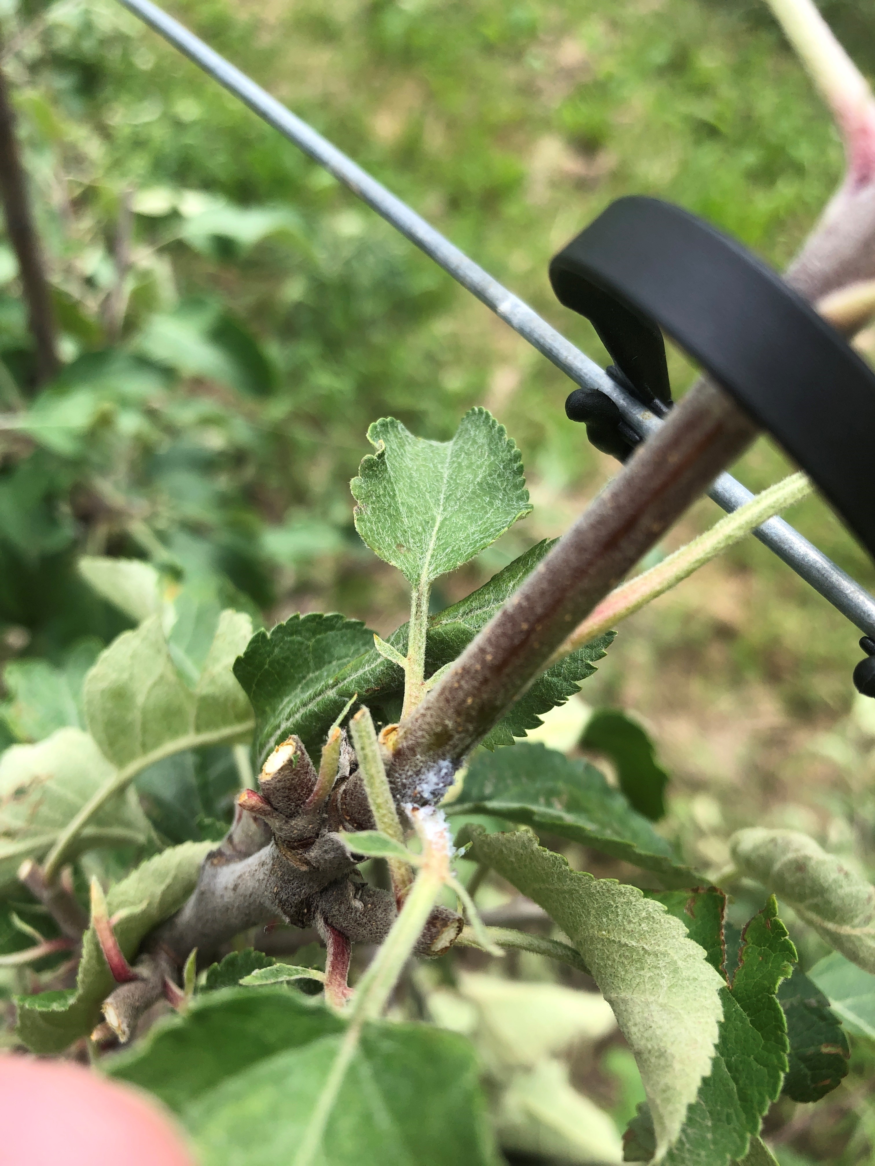
Woolly apple aphid and their fluffy white waxy coating are now starting to be visible in leaf axils. They can be very difficult to find now, but with early management being so important to keep woolly apple aphid at bay in late summer and early fall, good scouting now is key to good management of this sporadic pest. If you had high populations in fall 2020, scout for their presence now.
San Jose scale male flight seems to be over. A regional biofix for the general Grand Rapids area was set for May 20, with 622 degree days base 51 accumulated since that date. This timing indicates when crawlers need management with contact type insecticides. Crawlers can be found in blocks with a history of San Jose scale.
Oriental fruit moth adult flight is on the uptick as expected for the second generation. A biofix was set for the general Grand Rapids area for May 1. The Sparta MSU Enviroweather station has accumulated 1,042 degree days base 45 since that biofix. Second generation egg hatch is expected for July 2 or 3 and cover sprays will again be critical in stone fruits.
First apple maggot adults were reported in the past week. It is likely the heavy rainfall drove them out of their overwintering sites in the soil.
First reports of Japanese beetle adults are expected as well after the heavy rains.
Spotted wing Drosophila are just beginning to be caught in traps in many areas of Michigan. Numbers are expected to jump quickly over the next week or two – traps should be in place now to know when that occurs.


 Print
Print Email
Email

