Grand Rapids area tree fruit update – May 11, 2021
Cool conditions continue, suspending growth and development.

Weather update
Over the past week, the Grand Rapids, Michigan, region experienced very cool weather, a stark contrast to the warm conditions earlier part of the spring. The Michigan State University Sparta Enviroweather station has accumulated 465.4 growing degree days (GDD) base 42 since Jan. 1, which is approximately six days earlier than the average for May 10. This is much closer to normal than just a couple of weeks ago, when the region was nearly two weeks ahead of normal. The cool weather has been accompanied by windy, overcast conditions, and low overnight temperatures including frost in some locations.
Very little precipitation has occurred in the Grand Rapids region this spring. Less than 0.1 inch of accumulation was recorded in the past week at Enviroweather stations throughout the region. Over 75% of the state is currently under a moderate drought, or classified as category D1, according to the NOAA U.S. Drought Monitor classification scale. While this is typically a time of year in which Michigan experiences low levels of precipitation, the drier than normal conditions are concerning because soil moisture now will provide reserves for the rest of the season.
Over the next week, slightly warmer conditions are in the forecast. Highs will reach into the mid- to upper-60s degree Fahrenheit and overnight lows will remain above 40 F. Unfortunately, no precipitation is expected in the next five days. The first chance of showers is possible early next week, Sunday evening or Monday morning. A change in national weather patterns is expected to bring warmer air systems and precipitation into the region, with the chance for significant rain mid-week.
The cool temperatures have led to a suspension in growth and development in orchards. Bloom began over 10 days ago in early varieties such as Ginger Gold and Idared. Mid-season varieties, such as Gala, Fuji and Honeycrisp, are currently experiencing a prolonged bloom period, which has lasted over a week. Most varieties are nearing petal fall phenological growth stage or are expected to by the end of the weekend.
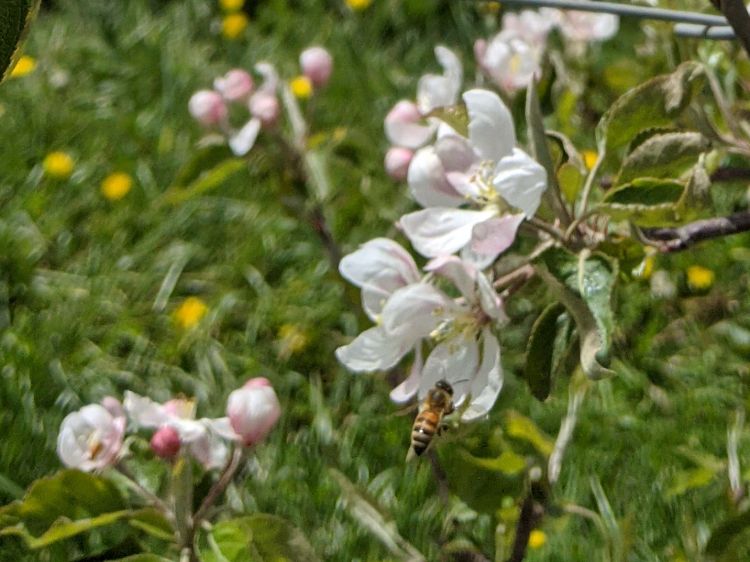
Pollination has been a significant concern in the area. High temperatures in the mid-50s, continuous gusty winds, overcast conditions and light rain have all been barriers to honey bee activity. However, a few windows of slightly warmer, sunny weather several afternoons last week have offered some good opportunity for bees to fly. In addition, the prolonged bloom has enabled overlapping of many varieties, and a few hours can provide a significant amount of pollination to apple orchards. Plenty of activity has been observed in the past week.
Some damage is being observed as a result of the hard freeze events on April 1-2, 21 and 22. The extent is highly dependent on variety, location and developmental stage at the time of the cold events. In most locations, damage is limited to king flower buds and there are plenty of healthy lateral blossoms to support a full crop.
Integrated pest management (IPM) considerations
All pest activity has been in a standstill with the cool and dry conditions over the last week. With warmer weather in the forecast for the coming weekend and into next week, insects will become much more active. Predicted dry conditions will keep disease pressure low.
Traps should be in place for major pests such as oriental fruit moth and codling moth and San Jose scale. Oriental fruit moth adults have been flying for a few weeks in sporadic numbers and with the warmer weather a sustained flight occurred over the past weekend. A biofix was set for the general Grand Rapids area for May 1. Mating disruption dispensers for oriental fruit moth and codling moth need to be in place no later than petal fall to be most effective.
Apples are still in bloom this week and bees are trying to work when the weather allows. Petal fall applications will be needed in about a week from now, but not until your bees and your neighbors’ bees are removed. Pests to target with petal fall applications in apple include plum curculio, San Jose scale, obliquebanded leafroller, mites and aphids.
Apple scab primary ascospores should be over 80% mature and the next rain events are likely to discharge a good number. High spore discharge numbers are expected in the next week or two—be cautious of stretching protectant fungicides too much. With a good deal of fresh, green tissue and tiny apples present, the risk for primary scab is a concern with any rain event from now until at least the end of May.
The cool stretch over the past two weeks was not conducive for powdery mildew in apple blocks, but the risk will likely still be there as warmer and maybe higher relative humidity conditions move back in next week.
Cold temperatures have made the risk for blossom blight due to fire blight a non-issue for the past 10 days. This is likely to change over the weekend and into next week. Bloom will quickly move to petal fall with warmer weather. We are seeing a wide range of blossom development on trees this season, so some rag tag bloom is likely to still be around when the warm weather moves in and this bloom will be a target for blossom blight to keep your eye on. Keep a close eye on your nearest MSU Enviroweather station for infection potential. Most blocks around the Grand Rapids area should have at least one application of prohexadione calcium on for shoot growth suppression and fire blight management.


 Print
Print Email
Email
