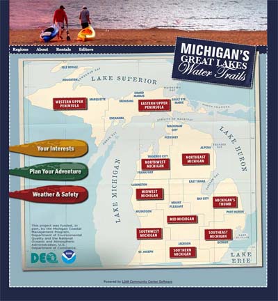
Michigan Great Lakes water trails highlighted on new website
Michigan paddlers now have online home for all Great Lakes water trail information.
One of the best ways to experience the Great Lakes and connecting waterways is to get out in a kayak or canoe. Picture it — a gentle breeze blowing, a paddle slicing through the clear water and a wonderful feeling of weightlessness as you glide over the surface of a Great Lake. The Michigan Great Lakes Water Trails website makes it easier than ever to hit the water — anywhere in the state.
Development of this website means that paddlers no longer need to search multiple websites to figure out where they want to paddle. Instead, they can now click on a region of the state and instantly find information on local water trails and their associated amenities. The new website also allows all of Michigan’s water trails to be promoted and marketed collectively.
Why Create a Great Lakes Water Trails Overview?
Over the years, many coastal communities in Michigan have developed information for paddlers to better access and enjoy their shorelines, but it hasn’t always been easy  to find and share the information, especially for visitors from outside the local area. Other coastal stretches have not yet been surveyed for access points and amenities. This project provided a starting point for an ambitious goal: a contiguous system of coastal water trails along every mile of Michigan Great Lakes shoreline.
Designed by Land Information Access Association (LIAA) and populated by local project partners and volunteers, the Great Lakes Water Trails website is a great first stop to help paddlers launch adventures. Digitally mapped trail information includes put-in and take-out spots along with suggestions and inside tips on the trails. Community organizations and paddling enthusiasts all over the state are adding more information every month, including insights like which routes are more difficult or which have large vessel traffic.
Who is Behind the Effort?
The effort to collect and share coastal water trail information in one place was part of a project funded by a grant from the Michigan Department of Environmental Quality Coastal Zone Management Program. Michigan Sea Grant, Michigan State University Extension, the nonprofit LIAA and other partners worked on the project to make Michigan’s water resources more accessible to residents and visitors.
The Michigan Great Lakes Water Trails Working Group is made up of volunteers from local, regional and state organizations who are concerned about the sustainability and resilience of Michigan’s coastal communities. The volunteers came together to explore the idea of statewide, contiguous water trails along Michigan’s Great Lakes coasts and connecting waters. The strategy was to create a framework to share information and coordinate marketing efforts for people interested in accessing Michigan’s spectacular shoreline, while promoting sustainability, tourism, recreation and related economic development in coastal communities. LIAA and Michigan Sea Grant led the working group and provided oversight for the project.
Pilot efforts for this project were conducted with the support and assistance of the Southwest Michigan Planning Commission along southern Lake Michigan, and with Riverside Kayak Connection, Michigan Sea Grant and the Metropolitan Affairs Coalition in the southeast area of the state.
Founded in 1993, LIAA is a federally approved 501(c)3 nonprofit community service organization that helps people shape better communities through participation, education, information and the effective use of technology. Headquartered in Traverse City, Michigan, LIAA provides innovative community-building and support services for governments, organizations and individual citizens, including community planning and development; website, software and database development and IT support; geographic information systems (GIS) and mapping; community-access media and video production; and related training and education. See: www.liaa.org


 Print
Print Email
Email

