Southwest Michigan field crop update – Aug. 13, 2020
Warm and dry turns to cool and dry this coming week, but most crops continue to look good with low pest and disease pressure reported.
Weather
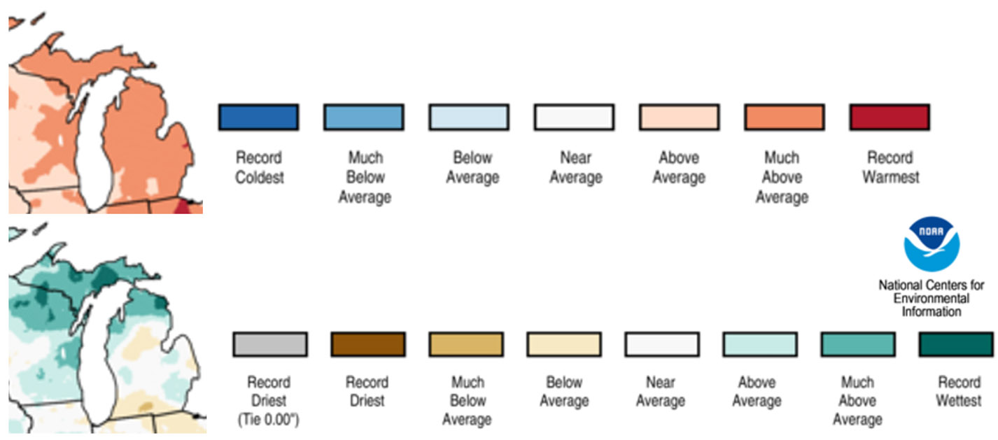
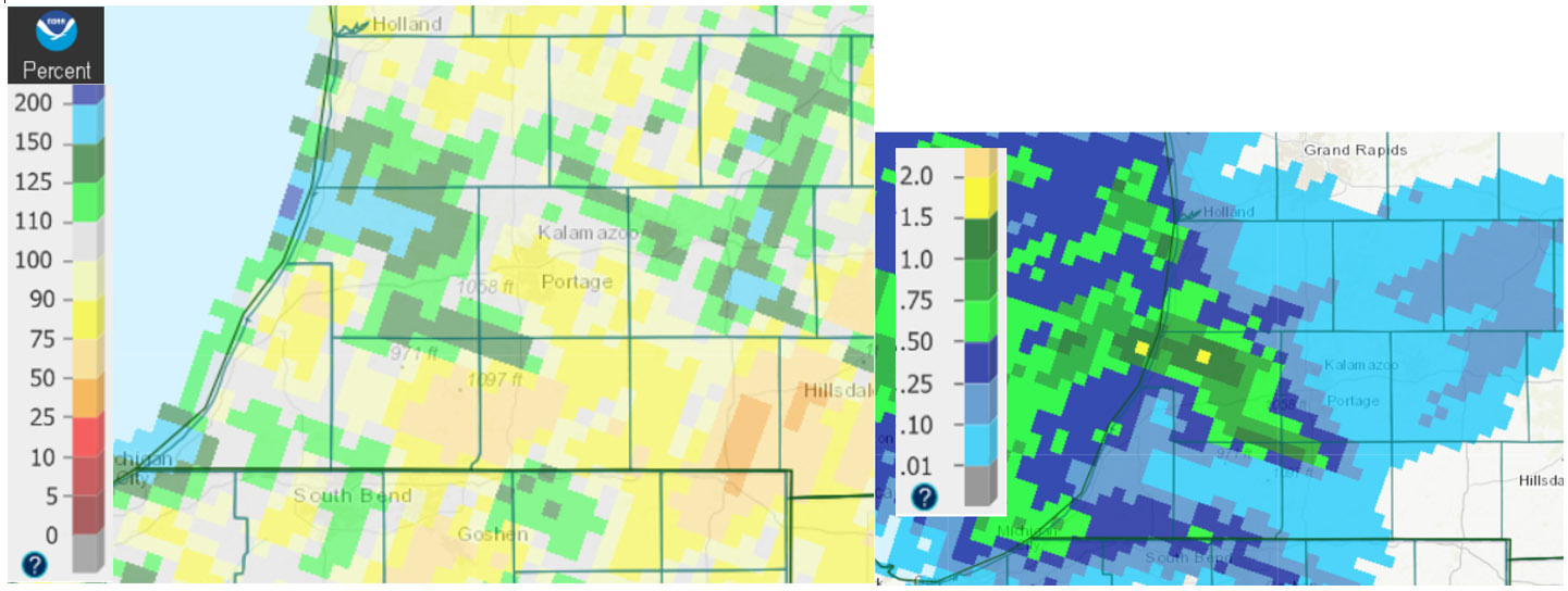
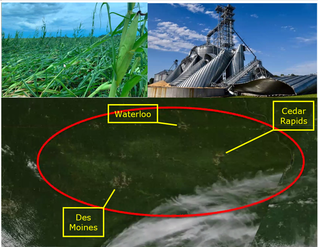
July was unusually hot and dry for south central Michigan this year. The average temperature was 4.3 degrees warmer than the 126-year normal. The state overall was wetter than normal only because of the upper third of the state, but we were below normal in our region. The widespread rains that fell at the beginning of August were tremendously helpful with 1.5 inches on average for the region. Those of you who watched the radar this past Monday and expected to receive another needed dose of rain were most likely disappointed as little of that made it this far east after passing over Lake Michigan. Don’t be too disappointed though, as it appears we missed the worst of what meteorologists call a Derecho event—a cluster of individual, self-perpetuating thunderstorms associated with damaging winds and hail. MSU Extension ag climatologist Jeff Andresen says this is the worst one to hit the Midwest in the past decade…see pictures below.
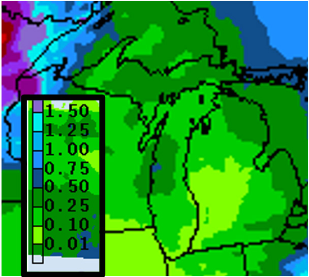
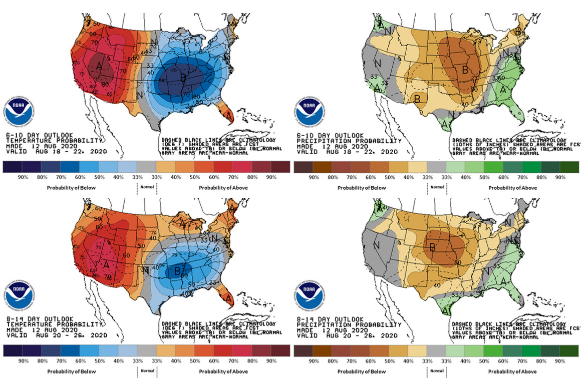
We can’t expect more than 0.5 inch of rain in the coming week either—less than 0.25 inch as you move west—according to the National Weather Service. The next chance of rain is over the weekend but forecasted amounts are small. The mid-range forecast is calling for cooler than normal temperatures next week, but these will moderate to normal temperatures toward the end of the month. All models continue to call for drier than normal conditions for the rest of the month.
Crops and pests
About a third of early-planted corn in Michigan has reached the dough stage (R5) according to the latest USDA Crop Report, but most of the crop is still at the blister (R3) or milk (R4) stages and the latest plantings are still finishing up pollination. The latest USDA estimates for crop condition have been holding steady this past month with 61 percent rated good or excellent and an additional 28 percent fair. Corn that was planted after the early May freeze event should reach black layer by the end of September.
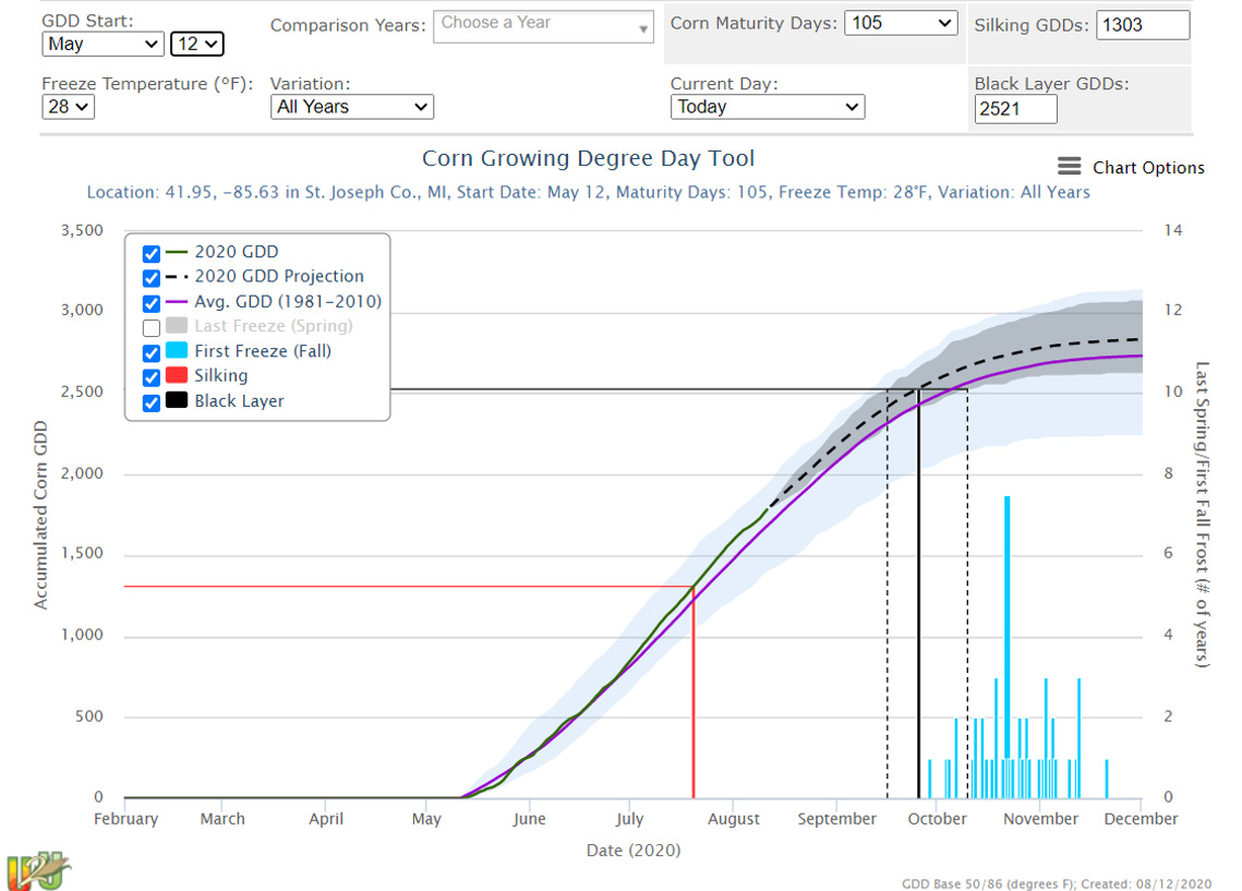
U2U Useful to Usable corn growing degree day (GDD) tool showing historic first fall freeze date range and expected date of black layer based on the parameters given.
Most soybeans have reached beginning pod (R3) or full pod (R4) stage with earliest fields likely at beginning seed (R5, seed is 1/8 inch long in the pod at one of the four uppermost nodes on the main stem). The USDA crop condition ratings have also held pretty steady for soybean at 73 percent good or excellent and an additional 21 percent fair.
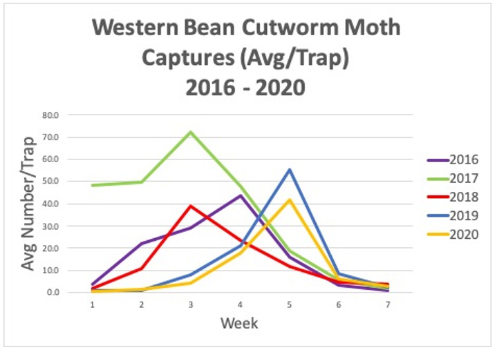
Western bean cutworm (WBC) trap counts have dropped off and are now close to nil. Purdue’s trapping network showed peak flight the week of July 16-22 (see graph) while MSU Extension field crops entomologist Chris DiFonzo says peak flight according to her traps on campus was during the week of July 27. Assuming the moths hit our region around July 23, eggs would have been hatching during the first week of August. Chris says a portion of those larvae would have crawled right into the silks and the rest should have entered silks by now, so essentially all WBC larvae would be feeding in relative security on ear tips. I, however, have yet to lay eyes on my first egg mass this year.


 Print
Print Email
Email