


CREP Prioritization: Mapping Sediment Loading Risk in the Lake Macatawa Basin
DOWNLOADMarch 27, 2022
 Print
 Email
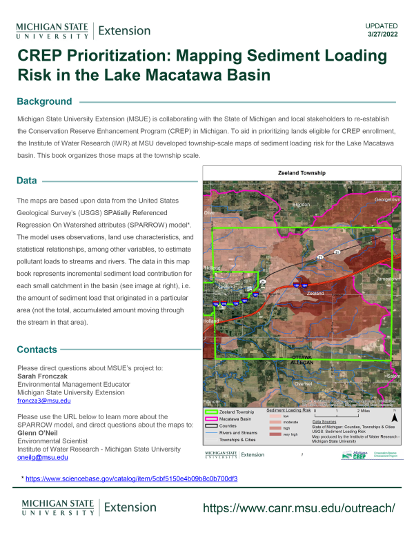
Michigan State University Extension (MSUE) is collaborating with the State of Michigan and local stakeholders to re-establish the Conservation Reserve Enhancement Program (CREP) in Michigan. To aid in prioritizing lands eligible for CREP enrollment, the Institute of Water Research (IWR) at MSU developed township-scale maps of sediment loading risk for the Lake Macatawa basin. This book organizes those maps at the township scale.
You Might Also Be Interested In
-
Protecting Michigan’s environment and wildlife through the Conservation Reserve Enhancement Program
Published on September 1, 2021
-
Cover Crops Virtual Field Day - Kellogg Biological Station
Published on September 1, 2020
-
Cover Crops Virtual Field Day - D'Arcy Farms
Published on September 1, 2020
-
Innovative Cropping Systems Virtual Field Day - Dry Beans
Published on August 26, 2020
-
Innovative Cropping Systems Virtual Field Day - Hasenick Brothers Farm
Published on August 26, 2020
-
Innovative Cropping Systems Virtual Field Day - Planting Cover Crop Mix
Published on August 26, 2020
Accessibility Questions:
For questions about accessibility and/or if you need additional accommodations for a specific document, please send an email to ANR Communications & Marketing at anrcommunications@anr.msu.edu.