CREP Prioritization: Mapping Sediment Loading Risk in the Saginaw Bay Basin - Roscommon County
DOWNLOADMarch 27, 2022
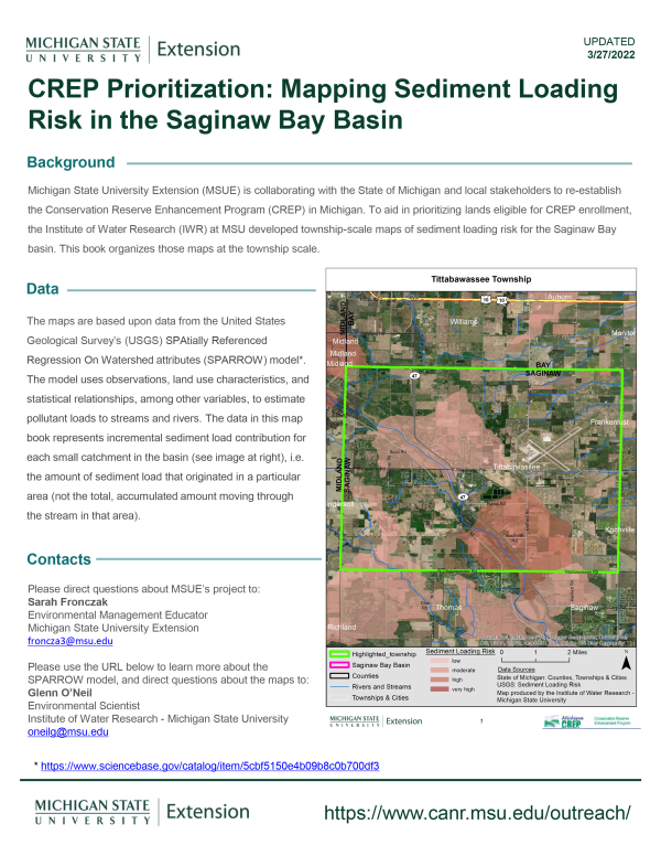
Michigan State University Extension (MSUE) is collaborating with the State of Michigan and local stakeholders to re-establish the Conservation Reserve Enhancement Program (CREP) in Michigan. To aid in prioritizing lands eligible for CREP enrollment, the Institute of Water Research (IWR) at MSU developed township-scale maps of sediment loading risk for the Saginaw Bay basin. This book organizes those maps at the township scale.
You Might Also Be Interested In
-
Marquette Area Climate and Health Adaptation Guidebook - Volume III: Prioritizing and Implementing Recommendations
Published on September 19, 2019
-
Climate and Health Adaptation Planning Guide for Michigan Communities
Published on October 2, 2020
-
Marquette Area Climate and Health Adaptation Guidebook - Volume I: Stakeholder Engagement and Visual Design Imaging
Published on January 18, 2019
-
Marquette Area Climate and Health Adaptation Guidebook - Volume II: Policy and Metric Recommendations
Published on January 18, 2019
-
Cover Crops Virtual Field Day - Kellogg Biological Station
Published on September 1, 2020
-
Innovative Cropping Systems Virtual Field Day - Dry Beans
Published on August 26, 2020
Accessibility Questions:
For questions about accessibility and/or if you need additional accommodations for a specific document, please send an email to ANR Communications & Marketing at anrcommunications@anr.msu.edu.