


Remote Sensing and In-Situ Monitoring
REMOTE SENSING and IN-SITU MONITORING
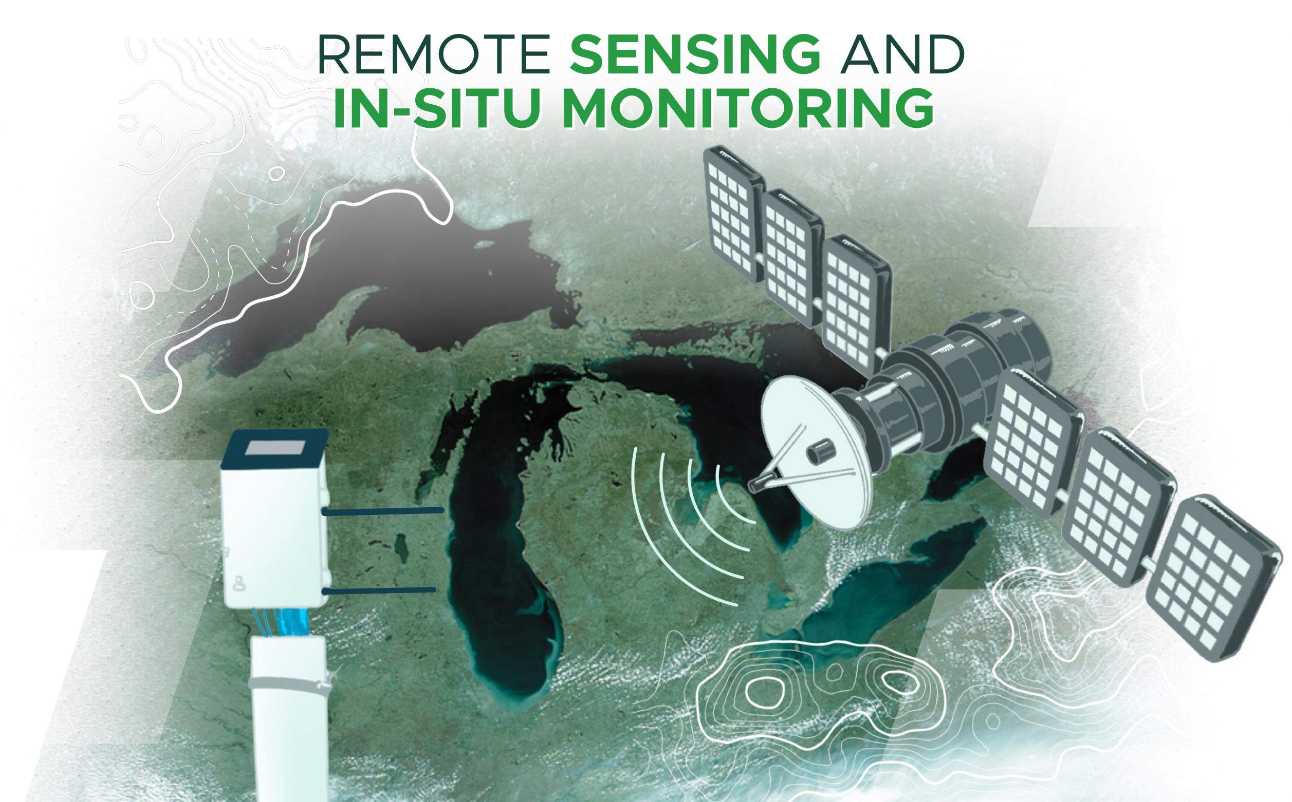
As the MSU’s hub for water research, education, technology, and stakeholder engagement, we coordinate cross-disciplinary efforts in remote sensing, in-situ monitoring, and decision support for water resources and agriculture in Michigan and beyond, linking campus expertise with partner agencies and communities. Priorities include:
Algorithm Development: high-resolution soil moisture retrievals from SAR and radiometer observations, vegetation classification/mapping, vegetation water content estimation, and crop phenology tracking.
Farm-scale services: irrigation detection and planning; crop health monitoring, crop yield estimate, pest management and vulnerability map, and efficient farm management.
Tools & training: reproducible analytics, dashboards, and capacity building for practitioners and students.
Present Issues
- Scale mismatch and representativeness: Satellite products (even ~50 m NISAR) sample landscape-scale signals that may not capture within-field heterogeneity (microtopography, management strips, tile drains). Translating pixel-scale soil moisture into actionable, plant-scale guidance remains challenging.
- Uncertainty in retrievals and assimilation: SAR backscatter → surface moisture retrievals require vegetation and roughness corrections; propagating those uncertainties through hydrologic assimilation to produce reliable 0–1 m profile is nontrivial and affects confidence in management recommendations.
- Validation data scarcity and diversity: Robust validation needs multi-depth, multi-site networks across soil types, drainage classes (tile vs. non-tile), and management regimes. Deploying sufficient in-situ sensors at scale is expensive and logistically complex, limiting model generalizability.
- Integration into operational farm workflows (DSS adoption): Producing science-grade products is different from creating farmer-usable advice. Usability, trust, real-time delivery, and clear uncertainty communication are necessary for adoption by growers and agencies; socio-technical barriers persist.
- Generalization of AI/ML models across regions and seasons: AI models trained in one region/season often degrade under different climates, cultivars, or management. Ensuring transferable, interpretable, and robust ML models while avoiding overfitting to pilot sites.
Our Vision
- Advance High-Resolution Soil Moisture Retrievals: Develop and validate next-generation algorithms using NASA’s SMAP and NISAR missions to achieve reliable, field-scale (~50 m) soil moisture products that capture spatial heterogeneity in agricultural landscapes.
- Integrate Earth Observation with AI and Hydrologic Modeling: Fuse multi-sensor satellite data (SAR, optical, thermal) with AI-driven hydrologic models to improve root-zone soil moisture estimation, enabling predictive insights into water availability, crop stress, and yield potential.
- Bridge Satellite Science to Farm Decision Systems: Translate satellite-derived soil moisture and crop condition data into Decision Support Systems (DSS) that empower farmers and policymakers with actionable intelligence for irrigation optimization, disease forecasting, and pest management.
- Strengthen Validation and Ground Networks: Expand in-situ calibration networks across diverse soil types and cropping systems to improve retrieval accuracy and ensure operational readiness of satellite-based soil moisture products for agricultural use.
- Promote Sustainable Water–Food Security: Leverage Earth observation science to support climate-smart agriculture, reduce irrigation inefficiencies, and enhance drought resilience and groundwater sustainability, ensuring long-term water and food security in the U.S. and globally.
Team Leadership
Team Lead:
Dr. Narendra N. Das — Water & Climate Lead, Institute of Water Research (IWR)

Professor Narendra N. Das is the Remote Sensing Lead at the Institute of Water Research (IWR). He is a leading researcher in Earth and environmental sciences, specializing in microwave remote sensing of soil moisture, hydrologic modeling, and agricultural water resource management. His work focuses on integrating satellite-based observations, including data from NASA’s SMAP, and NISAR missions, with physical and AI-driven models to enhance drought monitoring, irrigation optimization, and crop health assessment. Dr. Das has pioneered methods for high-resolution soil moisture retrieval and their applications in improving agricultural productivity and resilience. His research advances NASA’s and USDA’s missions in sustainable water use, climate adaptation, and food security through innovative, data-driven decision support systems.
Tagline: SAR, Radiometer, High-Resolution Soil Moisture, Decision Support for Farm management.
Research Areas:
- Remote sensing in hydrology
- Remote Sensing of Earth Surface
- Microwave remote sensing of soil moisture
- Radar (SAR) and radiometer synergy
- Soil physics and soil hydrology
- Hydrological modeling
- Inverse modeling/data assimilation
- High performance computing for RS-agro-hydrological modeling
- Statistical downscaling of soil moisture (spatial and temporal scaling)
- Climate-based (GCM) crop forecasting methods
- Citizen Science for satellite observations calibration and validation
Contact:
Email: dasnaren@msu.edu
Phone: +1 5176147758
Office: 223 Farrall Agricultural Engineering Hall, 524 S. Shaw Lane. East Lansing, MI 48824
Collaborators:
Dr. Rajat Bindlish

Research Scientist
SMAP deputy Project Scientist
Goddard Space Flight Center
NASA
email: rajat.bindlish@nasa.gov
Dr. Andreas Colliander

Senior Scientist
Finnish Meteorological Institute
Helsinki, Finland
email: andreas.colliander@fmi.fi
Dr. Dara Entekhabi

Professor,
Bacardi and Stockholm Water Foundations Chair
Massachusetts Institute of Technology
Cambridge, MA, USA
email: darae@mit.edu
Simon Yueh

Senior Research Scientist
NASA, Jet Propulsion Laboratory
California Institute of Technology
Pasadena, California, USA
email: simon.h.yueh@jpl.nasa.gov
Rowena Lohman

Professor
Department of Earth and Atmospheric Sciences
Cornell
Ithica, New York, USA
email: rbl62@cornell.edu
Ismail Jibrin

MD (Doctor of Medicine)
Human Capital Managers
Gombe, Nigeria
email: ismail.jibrin@hcm.ng
Thuy Ngo

Senior Researcher
Deputy Director
Hydrology and Oceanography Research Center
The Vietnam Institute of Meteorology
Hydrology and Climate Change (IMHEN)
Ministry of Agriculture and Environment
Ha Noi, Vietnam
email: tide4586@gmail.com
Duc Trinh Tran

Research Fellow Coordinator
The Business School, Saigon South Campus
Royal Melbourne Institute of Technology
Ho Chi Minh City, Vietnam
email: mailto:ductrinh.tran@rmit.edu.vn
Susantha Jayasinghe

Senior Climate Data Specialist
Asia Disaster Preparedness Center (ADPC)
Bangkok, Thailand
email: susantha@adpc.net
Selected Publications:
NASA mission-related publications
- Algorithm Theoretical Basis Document (ATBD), NISAR L3 Soil Moisture Data Product Algorithm Theoretical Basis Document, Jet Propulsion Laboratory, Michigan State University, Goddard Space Flight Center, Cornell University, 2022. (Co-author). Peer Reviewed.
- Algorithm Theoretical Basis Document (ATBD), SMAP L2 SMAP-Sentinel Radiometer/Radar Soil Moisture (Active/Passive) Data Product: L2_SM_SP, NASA, Jet Propulsion Laboratory, California Institute of Technology, 2018. Peer Reviewed.
- Algorithm Theoretical Basis Document (ATBD) JPL D-66481, SMAP L2 and L3 Radar/Radiometer Soil Moisture (Active/Passive) Data Product: L2_SM_AP and L3_SM_AP. NASA, Jet Propulsion Laboratory, California Institute of Technology. (Peer Reviewed), 2014. Peer Reviewed.
PEER-REVIEWED INTERNATIONAL JOURNAL ARTICLES
- Hashemi M G.Z, Alemohammad H., Jalilvand E., Tan P., Judge J., Cosh M., and Das N. N., (2025). Estimating crop biophysical parameters from satellite-based SAR and optical observations using self-supervised learning with geospatial foundation models. Remote Sensing of Environment. 327, 114825.
- Lal, P., Singh G., Lohman R. B., and Das N. N., (2025). Validation of NISAR multi-scale soil moisture retrieval algorithm across various spatial resolutions and landcovers using the ALOS-2 SAR data. Journal of Remote Sensing, vol 5, DOI: 10.34133/remotesensing.07.
- Mane S., Singh G., Das N. N., Kanungo A., Nagpal N., Cosh M. H., Dong Y., (2025). Development of Low-Cost Handheld Soil Moisture Sensor for Farmers and Citizen Scientists. Frontiers in Environmental Science 13 (https://doi.org/10.3389/fenvs.2025.15906).
- Singh G., Das N. N., and Prasad V., (2025). Geospatial monitoring and analysis of agricultural drought to identify hotspots and risk assessment for Senegal. Geography and Sustainability Volume 6, Issue 1, 100248. https://doi.org/10.1016/j.geosus.2024.10.004
- Nanda, A., Das N. N., Singh G., Bindlish R., Andreadis K., and Jayasinghe S., (2024). Harnessing SMAP Satellite Soil Moisture Product to Optimize Soil Properties to Improve Water Resource Management for Agriculture. Agriculture Water Management. vol. 300, 108918. (https://doi.org/10.1016/j.agwat.2024.108918)
- Lal, P., Singh G., Colliander A., Entekhabi D., and Das N. N., (2024). Uncertainty Estimates in the NISAR High-Resolution Soil Moisture Retrievals from Multi-Scale Algorithm. Remote Sensing of Environment 311, 114288. (https://doi.org/10.1016/j.rse.2024.114288)
- Hashemi M G.Z, Tan P. Tan, Jalilvand E., Wilke B., Alemohammad H., and Das N. N., (2024). A Systematic Review of Synthetic Aperture Radar and Deep Learning in Agricultural Applications. International Society for Photogrammetry and Remote Sensing. 218, 20-49. (https://doi.org/10.1016/j.isprsjprs.2024.08.018)
- Hashemi M G.Z, Tan P. Tan, Jalilvand E., Wilke B., Alemohammad H., and Das N. N., (2023). Yield Estimation from SAR Data Using Patch-Based Deep Learning and Machine Learning Techniques. Computers and Electronics in Agriculture. 226, 109340. (https://doi.org/10.1016/j.compag.2024.109340)
- Mane S., Singh G., Das N. N., Kanungo A., Nagpal N., Cosh M. H., Dong Y., (2023). Advancements in Dielectric Soil Moisture Sensor Calibration: A Comprehensive Review of Methods and Techniques. Computers and Electronics in Agriculture, Volume 218, March 2024, 108686. (https://doi.org/10.1016/j.compag.2024.108686)
- Singh G., Das N. N., Colliander A., Entekhabi D., Yueh S. H., (2023). Impact of SAR-based vegetation attributes on the SMAP high-resolution soil moisture product. Remote Sensing of Environment 298, 113826.
- Lal, P., Singh G., Colliander A., Entekhabi D., and Das N. N., (2023). A Multi-Scale Algorithm for the NISAR Mission High-Resolution Soil Moisture Product. Remote Sensing of Environment 295, 113667.
- Lal, P., Shekhar A., Gharun M., and Das N. N., (2023). Spatiotemporal evolution of global long-term patterns of soil moisture. Science of The Total Environment, 161470.
- Jalilvand, E., Abolafia-Rosenzweig R., Tajrishy M., Kumar S., and Das N. N., (2023). Is it Possible to Quantify Irrigation Water-Use by Assimilating a High-Resolution Soil Moisture Product? Water Resources Research 59 (4), e2022WR033342.
- Lal, P., Singh G., Das N. N., Colliander A., Entekhabi D., (2022). Assessment of ERA5-Land Volumetric Soil Water Layer Product Using In Situ and SMAP Soil Moisture Observations. IEEE Geoscience and Remote Sensing Letters,19, 1-5.
- Hashemi, M. G. Z., Abhishek A., Jalilvand E., Jayasinghe S., Andreadis K., Siqueira P., and Das N. N., (2022). Assessing the impact of Sentinel-1 derived planting dates on rice crop yield modeling. International Journal of Applied Earth Observation and Geoinformation, vol 114, 103047.
- Singh Gurjeet and Das N. N., (2022). A Data-Driven Approach Using the Remotely Sensed Soil Moisture Product to Identify Water-Demand in Agricultural Regions. Science of Total Environment. https://doi.org/10.1016/j.scitotenv.2022.155893.
- Jalilvand, E., Abolafia-Rosenzweig R., Tajrishy M., and Das N. N., (2021). Evaluation of SMAP/Sentinel 1 High-Resolution Soil Moisture Data to Detect Irrigation Over Agricultural Domain, IEEE JSTARS, DOI:10.1109/JSTARS.2021.3119228.
- Abhijeet A., Das N. N., Konstantinos A., Ines A. V. M., and Jayasinghe S. (2020). Evaluating the impacts of drought on rice productivity over Cambodia in the Lower Mekong Basin, Journal of Hydrology, Vol. 599, August 2021, 126291.
- Das N. N., D. Entekhabi, R. S. Dunbara, M. J. Chaubell, A. Colliander, S. Yueh, T. Jagdhuber, F. Chen, W. Crow, P. E. O'Neill, J. P. Walker, Aaron Berg, D. D. Bosch, T. Caldwell, M. H. Cosh, C. H. Collins, E. Lopez-Baeza, and M. Thibeault., (2019). “The SMAP and Copernicus Sentinel 1A/B microwave active-passive high resolution surface soil moisture product, Remote Sens. Environ., vol. 233.
 Print
Print Email
Email