Tracking phosphorus in Western Lake Erie: Why harmful algal blooms keep returning
 Print
Print Email
EmailHow phosphorus movement from fields to water fuels repeated algal outbreaks.
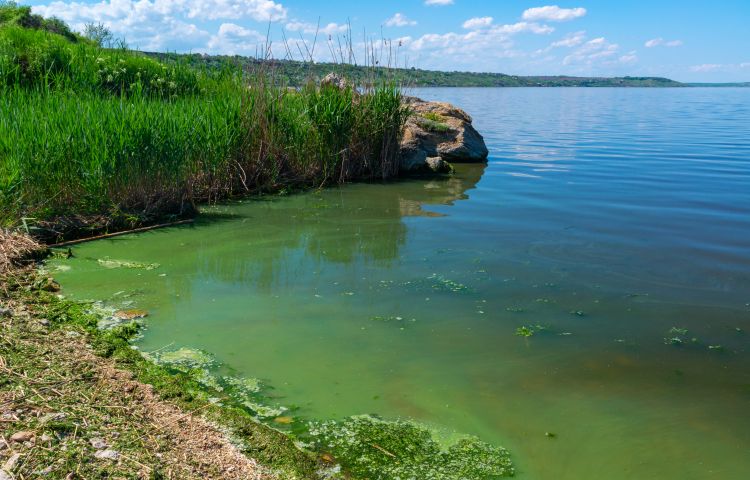
Harmful algal blooms (HABs) have become a recurring concern in Western Lake Erie, affecting water quality, recreation and drinking water supplies. These blooms can produce toxins that pose risks to people and wildlife. In 2014, a severe bloom left nearly 500,000 residents in the Toledo, Ohio area without safe tap water for several days. So why do these blooms keep happening?
The role of phosphorus
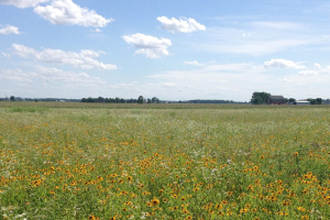
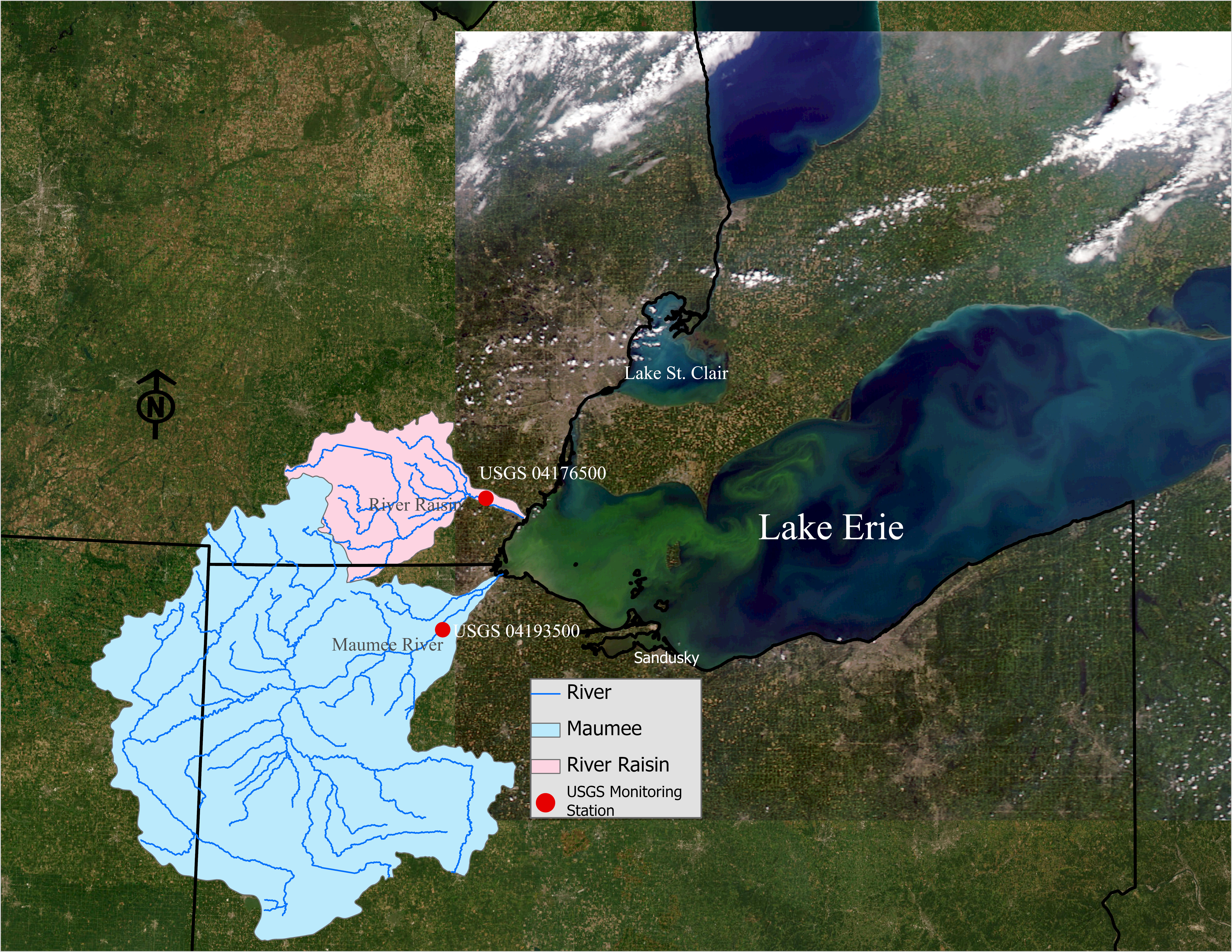
Excess phosphorus in the water is the primary driver of HABs. Rainfall and snowmelt wash phosphorus off farm fields and urban areas into rivers like the River Raisin and Maumee River, which carry it into Lake Erie.
Phosphorus is transported from the land to nearby streams and rivers primarily in two forms:
- Particulate phosphorus: where phosphorus is attached to soil particles and moves through soil erosion
- Dissolved phosphorus: where phosphorus is soluble in water and moves through surface runoff and tile drainage
Total phosphorus represents the sum of both particulate and dissolved forms. Out of these, dissolved phosphorus is the key driver of HABs, as it is readily available for uptake by plants and algae, promoting rapid growth.
Efforts over the past few decades have reduced overall (total) phosphorus in some areas. For example, the River Raisin has seen declines in total phosphorus partly due to better wastewater treatment and reduced erosion. But there’s a catch: Dissolved phosphorus has increased by nearly 40% in recent decades.
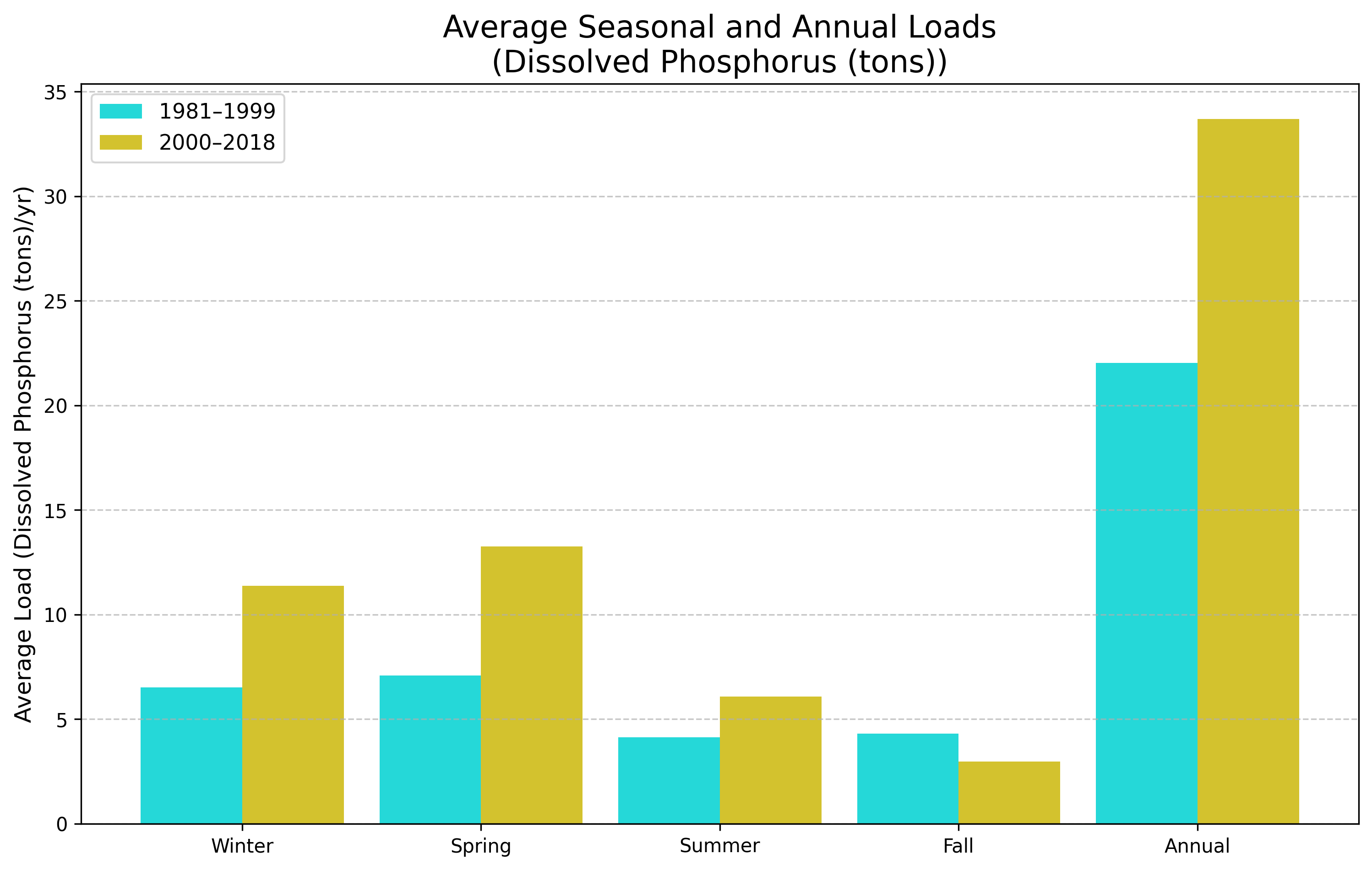
Even as total phosphorus declines, the form that drives blooms is rising, helping explain why HABs persist. Several factors are driving this increase, including more intense rainfall that increases runoff, tile drainage systems that quickly move water (and nutrients) off fields, and legacy phosphorus stored in soils over time. These conditions speed the movement of dissolved phosphorus from land to water. In Western Lake Erie’s shallow, nutrient-rich waters, even small increases can trigger significant algal growth.
We’ve made progress, but the challenge is evolving. Understanding the rise of dissolved phosphorus is key to developing solutions that protect Lake Erie moving forward.
Learn more
This article highlights just part of the story. To learn more about the total phosphorus loading trends from the River Raisin and phosphorus loading trends from the Maumee River (the largest tributary to Western Lake Erie), please refer to the full Michigan State University Extension bulletin E3544: Harmful Algal Blooms in Western Lake Erie.